• Home
  • Information
  • Cruise Pages
    • BATHYLUCK
    • EDUL
    • ERODER
    • FOREVER
    • GRAVILUCK
    • HYDROSNAKE
    • MOMAR'08
    • MOMARDREAM
    • MOMARSAT Cruises
    • ODEMAR
    • ROVSMOOTH
    • SAMUDRA
    • SMOOTHSEAFLOOR
    • SUBSAINTES
    • SWIFT
  • Home
  • Information
  • Cruise Pages
    • BATHYLUCK
    • EDUL
    • ERODER
    • FOREVER
    • GRAVILUCK
    • HYDROSNAKE
    • MOMAR'08
    • MOMARDREAM
    • MOMARSAT Cruises
    • ODEMAR
    • ROVSMOOTH
    • SAMUDRA
    • SMOOTHSEAFLOOR
    • SUBSAINTES
    • SWIFT
  LITHOTHÈQUE IPGP - IPGP ROCK REPOSITORY
  • Home
  • Information
  • Cruise Pages
    • BATHYLUCK
    • EDUL
    • ERODER
    • FOREVER
    • GRAVILUCK
    • HYDROSNAKE
    • MOMAR'08
    • MOMARDREAM
    • MOMARSAT Cruises
    • ODEMAR
    • ROVSMOOTH
    • SAMUDRA
    • SMOOTHSEAFLOOR
    • SUBSAINTES
    • SWIFT

SWIFT-MD121 - 2001

South West Indian Ridge (~33°-52°E)
19/02/2001 - 21/03/2001
Cruise onboard N/O Marion Dufresne to study petrology and segmentation along the South-West Indian Ridge axis. 
PI: E. Humler
Sampling: Dredging.

Cruise info: 
https://doi.org/10.17600/1200030 
Cruise Report:
https://doi.org/10.13155/55300

​Files: Dredges (files finishing with _dre.xls), dredge samples (_drs.xls) and KML file of dredges:
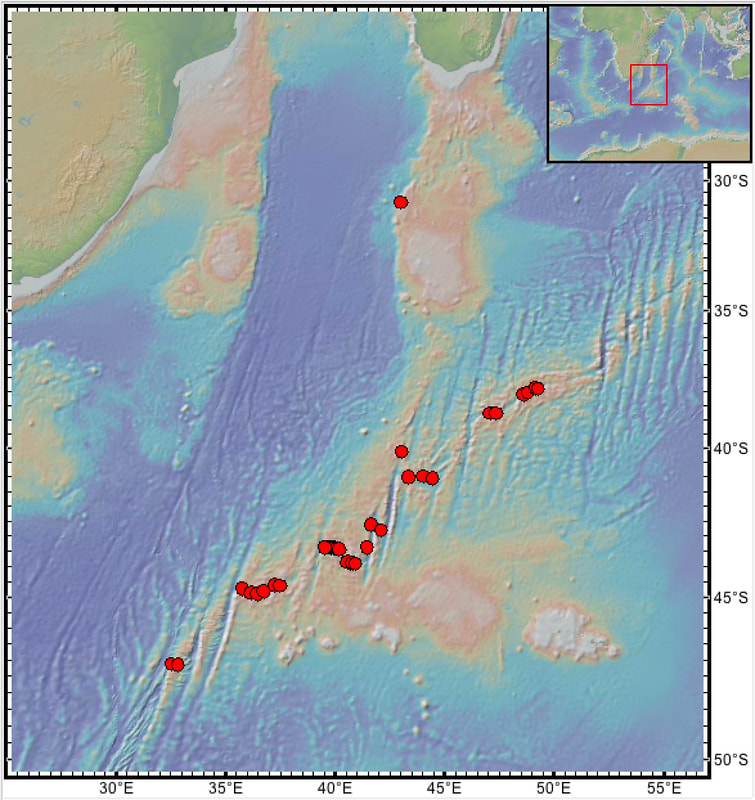
swf_dre.xls
File Size: 55 kb
File Type: xls
Download File

swf_dre.kml
File Size: 23 kb
File Type: kml
Download File

swf_drs.xls
File Size: 290 kb
File Type: xls
Download File

Picture
Map: Red: dredges.